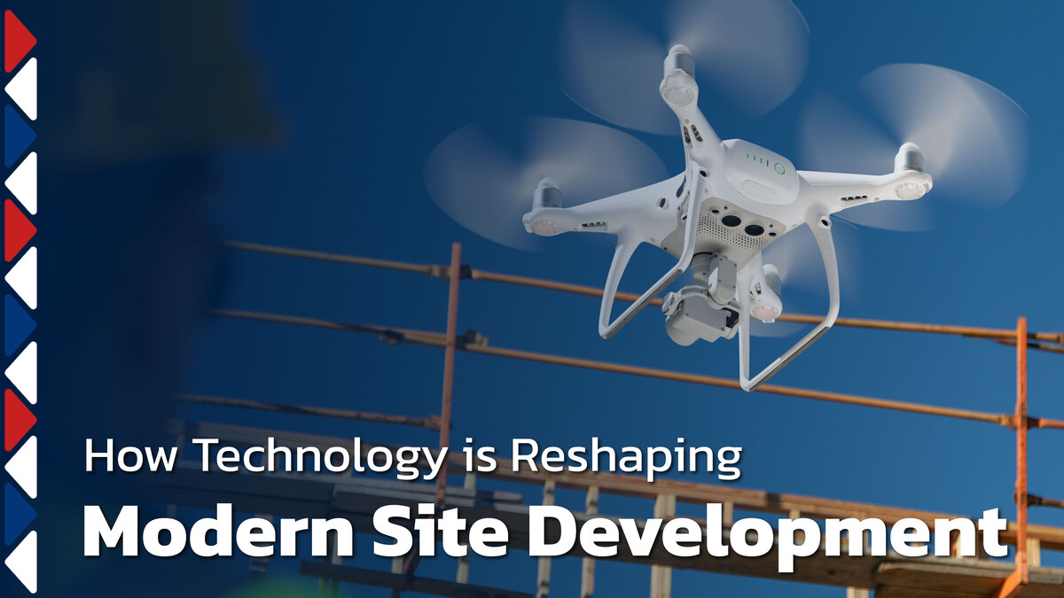
How Technology Is Reshaping Modern Site Development
Large site development projects carry enough complexity without outdated tools making things harder. Limited visibility and delayed feedback create rework that costs time and money.
When crews rely on disconnected tools and manual checks, small errors compound into major setbacks. Modern technology offers a better path when applied with discipline.
This blog explains how drones, 3D modeling, GPS equipment, and real-time monitoring improve precision and coordination on active sites. You'll see how experienced contractors integrate these tools into proven field practices without chasing trends.
Use Technology to Strengthen Proven Field Practices
Technology does not replace experience. It supports better decisions, faster verification, and tighter control when crews apply it correctly.
Pair Field Knowledge with Digital Tools
Experienced operators and foremen use technology to confirm grades, slopes, and alignments instead of guessing or revisiting work. A GPS-guided excavator validates elevations in real time. A drone survey confirms drainage paths before utility installation begins.
Field knowledge still drives decisions. Technology removes uncertainty and catches issues before they affect critical work.
Reduce Rework through Early Verification
Early checks with modern tools catch errors before they affect utilities, concrete, or paving. A grade mistake identified during rough earthwork takes minutes to fix. The same error discovered after storm lines are installed requires excavation, reinstallation, and inspection delays.
Digital verification protects work already in place and keeps schedules moving forward.
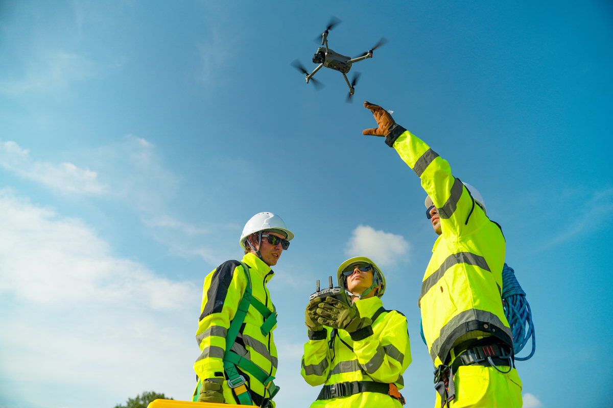
Gain Site Visibility with Drone Mapping and Aerial Data
Aerial imaging provides clear, current views of progress that ground-level checks miss. Drones capture site conditions quickly and accurately, giving project teams visibility into terrain, quantities, and sequencing challenges before problems develop.
Capture Accurate Existing Conditions
Drone surveys document terrain, drainage paths, and site constraints before excavation begins. This data helps identify grading challenges, locate existing utilities, and validate civil plans against actual conditions.
Accurate baseline data also supports better communication with engineers and owners. Everyone starts with the same view of site conditions rather than assumptions based on dated surveys.
Track Progress and Quantities from Above
Aerial data supports volume calculations, progress tracking, and schedule validation. Drones measure stockpiles, verify cut and fill quantities, and document site changes at regular intervals. When disputes arise over quantities or progress, aerial records provide objective documentation that protects all parties.
Improve Communication with Visual Documentation
Images and maps help align owners, engineers, and inspectors without lengthy explanations. A marked-up aerial photo shows exactly where work stands and what comes next. Visual records also support coordination between trades across large sites.
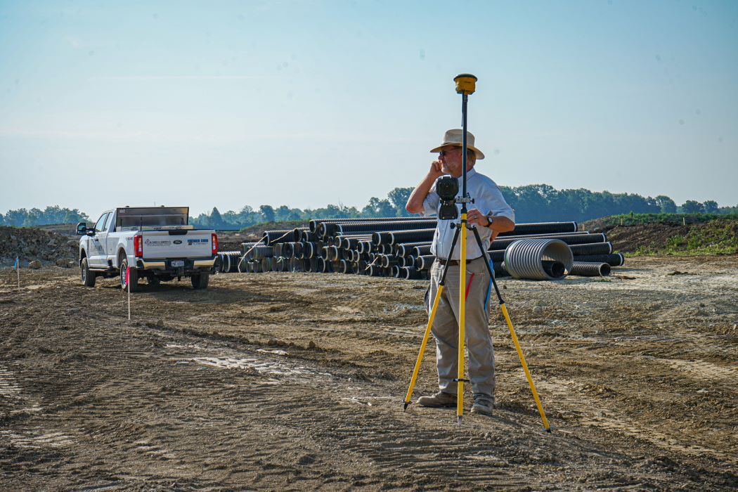
Improve Accuracy with 3D Models and GPS-Controlled Equipment
Digital models translate plans directly into field execution. GPS-guided equipment follows design elevations and slopes without constant re-staking.
Translate Civil Plans into Machine Guidance
GPS models guide equipment to precise elevations and slopes across large sites. Operators see target grades on in-cab displays and adjust blade angles in real time. This eliminates guesswork and reduces dependency on physical stakes that shift or get damaged during work.
Maintain Consistency across Crews and Phases
Shared digital models keep grades aligned as work transitions between excavation, utilities, and paving. When one crew completes rough grading, the next crew accesses the same model to verify subgrade elevations. This continuity prevents miscommunication and reduces rework.
Digital models also support inspection coordination. Inspectors verify work against the same data used by field crews, which speeds approvals and reduces disputes.
Reduce Dependency on Re-Staking
GPS control limits delays tied to layout conflicts or damaged stakes. Traditional staking requires surveyors to return each time stakes are disturbed. GPS-equipped machines carry the layout data internally, so work continues without waiting for re-staking.
Monitor Site Conditions in Real Time
Real-time data supports faster decisions and protects work already in place.
Track Elevations, Slopes, and Progress Daily
Frequent checks confirm work meets design standards at each stage. Crews verify compaction levels, drainage slopes, and alignment tolerances before moving to the next phase. This discipline prevents small deviations from turning into major corrections later.
Respond Faster to Weather and Soil Changes
Monitoring helps crews adjust sequences before conditions create delays or damage. When rainfall saturates subgrades, real-time data shows which areas remain stable and which need protection. This visibility allows foremen to shift resources to productive tasks instead of waiting for conditions to improve.
Support Better Coordination between Office and Field
Connected systems keep everyone aligned throughout the project lifecycle.
Share Data across Teams and Stakeholders
Real-time access to plans and updates reduces miscommunication. Project managers, engineers, and field crews work from the same information rather than relying on email chains or outdated printouts. When changes occur, everyone sees them immediately.
Document Decisions and Adjustments Clearly
Digital records support accountability with clients, engineers, and inspectors. When field conditions require design adjustments, documentation shows what changed, why it changed, and who approved it. This clarity protects all parties and prevents disputes during closeout.
Avoid the Pitfalls of Poor Technology Adoption
Technology only adds value when teams use it with discipline. Tools applied incorrectly create confusion and false confidence that leads to costly mistakes.
Treat Tools as Support, Not Shortcuts
Experience still drives decisions. Overreliance on software creates risk when crews ignore field conditions that contradict digital data. A GPS system shows target elevations, but the operator still verifies that drainage flows correctly, and that soil conditions support the design.
Train Crews to Use Technology Correctly
Proper training prevents misuse and protects accuracy in the field. Operators must understand how GPS systems calibrate, how models update, and when manual verification is still required.
Charles H. Hamilton invests in training, so crews use modern tools effectively. Our teams know when to rely on technology and when to apply traditional field checks.
Modernize Site Development with Charles H. Hamilton
At Charles H. Hamilton, we blend decades of field experience with proven technology to deliver accurate, efficient site development. Modern tools support stronger planning, cleaner execution, and dependable results when guided by experienced crews.
We use drones to track progress and verify conditions. We apply GPS guidance to maintain precision across large sites. We monitor work in real time to catch issues early and protect schedules.
If you're planning a site development project and want a contractor who modernizes proven methods rather than chasing trends, connect with us. Visit our Contact page to start your next project with confidence.